King Fahd Road
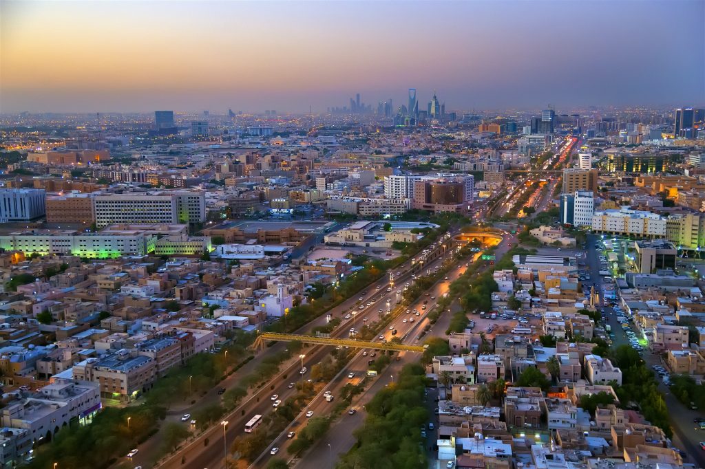
King Fahd Road is one of Riyadh’s principal transport arteries that links the city’s southern and northern districts. Its strategic role bolsters the Royal Commission for Riyadh City’s (RCRC) urban‑development efforts, supporting the revitalization of the city center and sustaining its position as the capital’s political, administrative, and commercial hub.
Vision
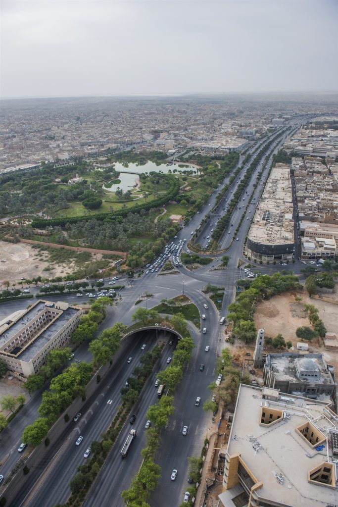
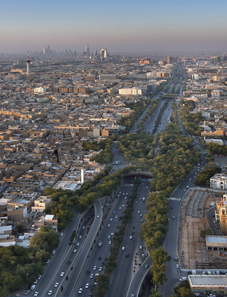
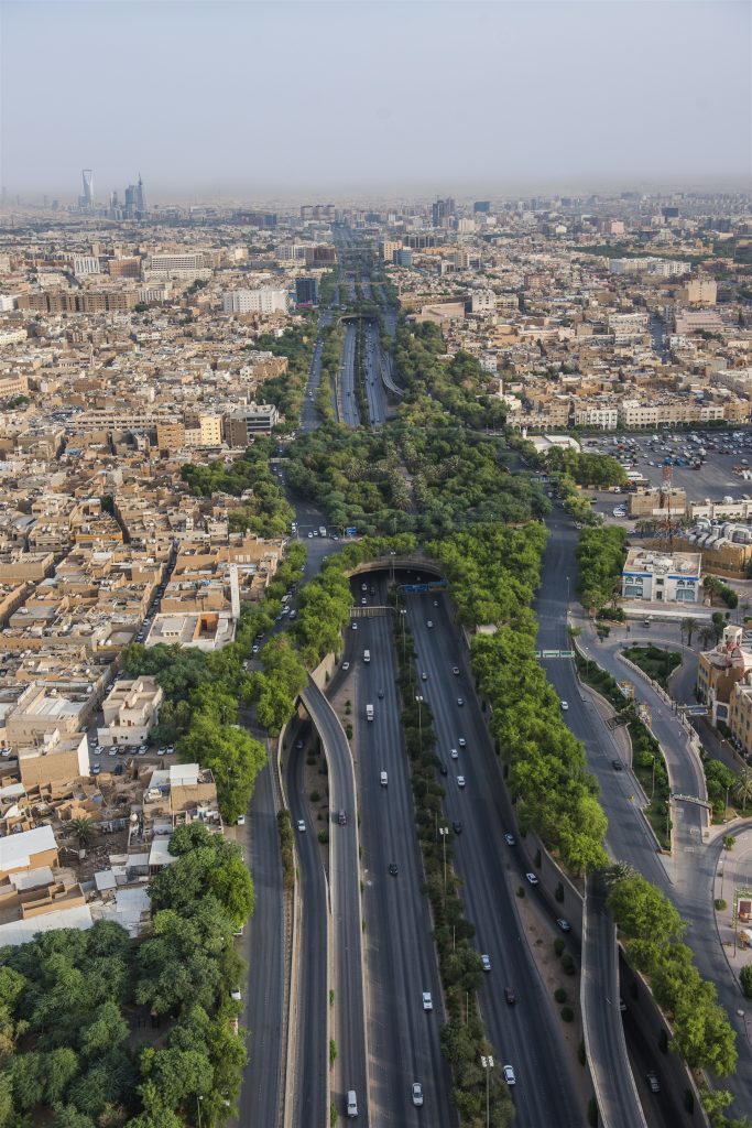
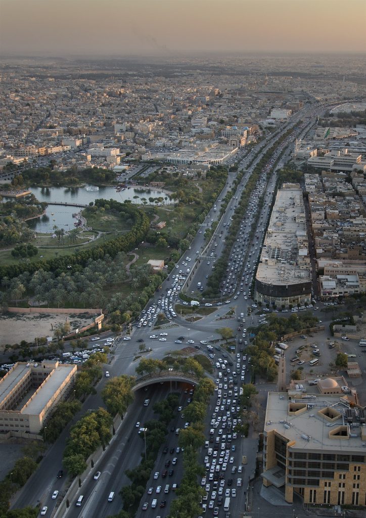
As part of its architectural development program, the RCRC planned, designed, and executed a 5.1 km stretch of King Fahd Road between Al‑Mazar Street and Aseer Street. The project met functional, environmental, and aesthetic objectives in equal measure. Because the road lies at the city’s heart, the design carefully balances efficient downtown traffic flow with safe, convenient mobility for both vehicles and pedestrians, achieved through a series of innovatively engineered overpasses.
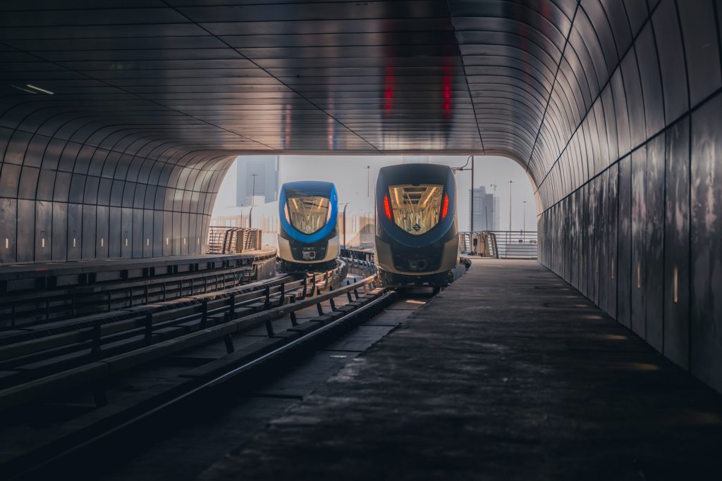
Supported by the necessary infrastructure for scalable advanced traffic management systems, the entire road has dedicated routes for fiber optic networks.
The road spans 95 meters in total width. At its center, a 40‑meter‑wide sunken roadway (open tunnel) runs about 8 meters below the ground surface. The main carriageway provides three lanes in each direction, flanked by emergency shoulders and a central median. On either side, 15‑meter‑wide service roads accommodate up to three additional lanes, boosting capacity near intersections. These service roads are separated from the mainline by an 8‑kilometer retaining wall that incorporates about 16 16 entrances and exits to the main road.
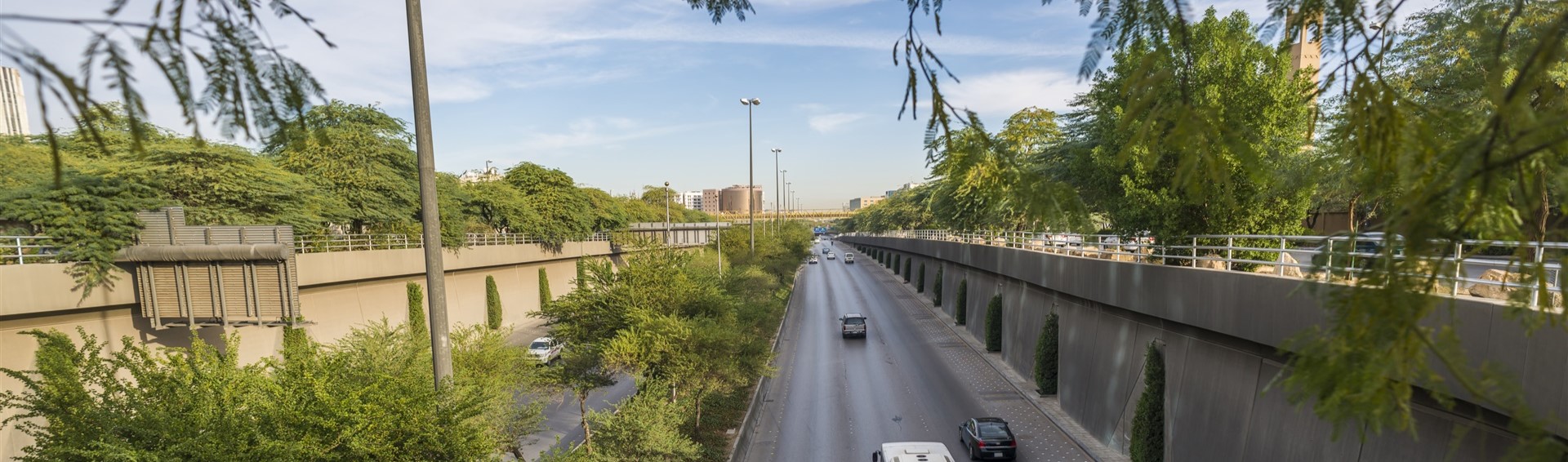
A dedicated 1.5-meter-wide pedestrian walkway runs alongside the road, buffered from service lanes by a line of trees.
The road design also incorporates landscaped sections, five ground-level tunnels, and an east-west overpass at Al-Washm Street, all contributing to enhanced traffic flow and pedestrian amenity.
Traffic Management
As part of the King Fahd Road development, RCRC deployed an advanced traffic management system, utilizing state-of-the-art control technologies, to optimize traffic flow and enhance safety.
Afforestation and landscaping
Extensive afforestation and landscaping were undertaken along several sections of the road to enhance aesthetics and help mitigate pollution impacts on adjacent residential areas. This involved planting approximately 8,000 trees and numerous shrubs. A key landscape feature is the 12,000 sq m park situated atop the covered tunnel connecting Imam Turki bin Abdullah and Imam Muhammad bin Saud Streets. Additionally, ten smaller parks equipped with seating, fountains, and children’s play areas are distributed along both sides of the road. Irrigation for these green spaces utilizes groundwater treated at dedicated on-site facilities.
Road’s Lighting System and tunnel Ventilation
Lighting systems throughout the tunnel sections adhere to the latest international standards, designed to maximize visibility and eliminate hazardous reflections. Along the main road, this involves 20-meter-high lampposts spaced at 70-meter intervals, complemented by five dedicated rows of lighting fixtures within the covered tunnel portions. Lighting intensity is increased at tunnel entrances to safely transition drivers from ambient sunlight. Adjacent service roads utilize 12-meter-high lampposts spaced every 35 meters.
Regarding ventilation, the tunnel connecting Imam Turki bin Abdullah and Imam Muhammad Bin Saud Roads is equipped with three powerful extraction fans in each direction. This system ensures adequate air exchange and quality, crucial due to the tunnel’s significant covered length in this section.
Groundwater Drainage System
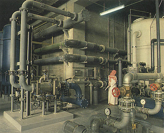
The King Fahd Road tunnel excavation also facilitated the installation of an extensive drainage system designed to lower the local groundwater table. This involved constructing over 1,000 wells, 8-10 meters deep, connected to four parallel drainage channels spanning 20 kilometers and terminating at two water collection and filtration plants. This integrated system effectively drains significant volumes of ground and surface water from the area. The collected water is either discharged into designated floodwater catchments or reused for irrigating the project’s green spaces and landscaping, as well as nearby developments like the King Abdulaziz Historical Center.
Redirection and Reconstruction of Public Utilities
Managing the redirection and reconstruction of intersecting public utility lines serving downtown posed a significant challenge, given their location within Riyadh’s oldest district; however, this was successfully overcome.
Utilities situated beneath the project site were temporarily rerouted during the road’s construction phase before being permanently reconstructed within dedicated utility corridors along the new alignment. Lines crossing beneath the road path were similarly relocated, often housed temporarily under bridge structures, prior to final reinstatement.
The smooth execution of these intricate works was attributed to RCRC’s exemplary coordination strategy with all relevant authorities.